Short answer
A geotechnical investigation is a site study (boreholes, test pits, sampling, lab testing and engineering analysis) that tells you what soil, rock and groundwater lie beneath a site and how they will behave under a building, road, wall or crane. It produces the design parameters your structural and civil engineers need: bearing capacity, settlement, foundation type, excavation and groundwater conditions, and frost and seismic considerations.
You have a lot, a concept and a budget, and someone has just asked for a “geotech report” before they will stamp the foundation drawings. It feels like one more hoop. It is actually the one study that tells everyone on the project what the site is made of, and it is cheaper to learn that from a drill rig than from an excavator with the clock running.
What is a geotechnical investigation?
A geotechnical investigation is a planned program of fieldwork, laboratory testing and engineering analysis that characterizes the soil, rock and groundwater beneath a site. Its purpose is to answer a practical question: what will the ground do when you build on it, cut into it, or load it?
The output is a geotechnical report. A good one does not simply list what was found; it tells your structural and civil engineers what to design for. That includes foundation type and depth, bearing resistance, expected settlement, excavation and shoring conditions, groundwater and dewatering, frost penetration, pavement structure, and any slope stability or seismic considerations that apply.
In Canada, Part 4 of the National Building Code requires a subsurface investigation, including groundwater conditions, carried out by a person competent in the field and to a degree appropriate for the building, its use, the ground and the surrounding site. The foundation design that follows draws on that investigation. The Canadian Geotechnical Society’s Canadian Foundation Engineering Manual (now in its 5th edition) sets out the practice that engineers in this country follow.
What does the fieldwork involve?
Every site is different, but the toolkit is fairly consistent.
- Desk study. Geological maps, air photos, old site plans, previous reports and, where relevant, environmental records. Around Saint John alone, bedrock ranges from Precambrian metamorphic rock to Carboniferous sandstone and shale, with glacial till, marine clay and fill on top. Knowing the likely setting before mobilizing a rig saves money.
- Test pits. An excavator opens pits to a few metres so the engineer can log the soil profile, note seepage and collect bulk samples. Fast and inexpensive for shallow footings, parking areas and utilities.
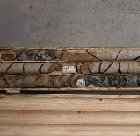
- Boreholes. A drill rig advances through soil with standard penetration testing at intervals (the “N” value that drives many design charts) and can core into bedrock to confirm its depth, quality and fracturing. Boreholes are where you learn that the “rock” at surface is a boulder, or that soft clay continues to 12 metres.
- In-situ testing and instrumentation. Depending on the problem: vane shear in soft clays, cone penetration testing, piezometers to track groundwater over time, inclinometers on slopes.
- Laboratory testing. Moisture content, grain size, Atterberg limits, consolidation, shear strength, compaction and, for marine or industrial sites, chemistry that affects concrete and steel durability. Fundy runs materials labs in Saint John and Clyde River.
- Analysis and reporting. The engineer turns the data into design recommendations and clearly states what was assumed and where the limits of the data lie.
What does the report actually tell you?
| Question on the project | What the geotechnical report provides |
|---|---|
| What foundation should we use? | Spread footings, raft, piles or rock anchors, with founding depth and bearing resistance for each option |
| Will the building settle? | Estimated total and differential settlement, and whether soft or compressible layers need preloading, ground improvement or deep foundations |
| How deep is rock, and can we excavate it? | Depth to bedrock across the site, rock quality, and whether ripping, hoe-ramming or blasting is likely |
| Where is the water? | Groundwater levels, seasonal variation, and dewatering or waterproofing implications |
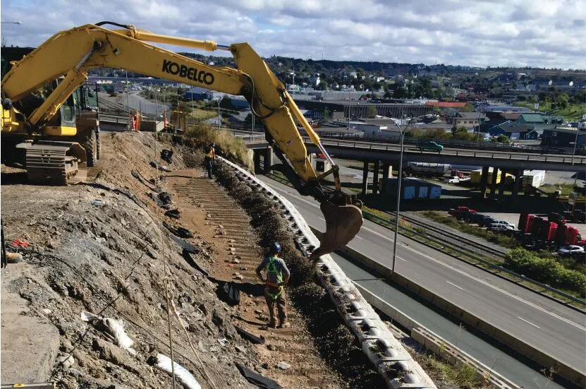
| Can we cut a slope or build a wall here? | Temporary and permanent slope angles, shoring needs, and global stability of retaining structures |
| What about frost and pavements? | Frost susceptibility, depth of frost penetration, and recommended pavement and granular structure |
| Can we reuse site material? | Suitability of excavated soil and rock as engineered fill |
Notice that most of these are cost questions in disguise. The report is what lets an estimator price a foundation instead of guessing at one.
What does it cost to skip one?
Nobody skips the investigation and saves money. They skip it and move the cost somewhere else, usually to the construction phase, where it arrives with a markup and a schedule hit. The common ways this plays out:
- Unexpected bedrock. Shallow rock is a gift if you know about it and a change order if you do not. Blasting next to neighbours brings its own obligations, which we cover in our guide to pre-blast surveys and vibration monitoring.
- Soft or variable soils. Marine clays, organic deposits and old fill are common along the Fundy coast and in former industrial areas. Footings sized for “typical” soil can settle unevenly for years.
- Groundwater. A basement designed without knowing the water table becomes a pumping and waterproofing problem the owner pays for every spring.
- Over-design. The flip side. Without data, a conservative engineer assumes the worst and specifies piles where footings would have done. You pay for safety you did not need.
- Temporary works failures. Cranes, shoring and haul roads need the same information as the permanent structure, a point we expand on in crane pads and temporary works.
An under-scoped investigation can be nearly as bad as none. One borehole in the corner of a site with a buried stream channel through the middle is a story every geotechnical engineer has heard.
How should you scope it?
A few rules of thumb from our geotechnical team:
- Match it to the structure. A single-storey warehouse and a six-storey concrete building on the same lot need very different programs.
- Cover the footprint, not just a corner. Spacing and depth should let the engineer draw a credible picture of the whole site.
- Go deeper than the foundation. Settlement and pile capacity depend on what is below the founding level, not just at it.
- Think about the whole project. Access roads, stormwater ponds, retaining walls, utility trenches and crane positions all benefit from the same mobilization.
- Do it early. The investigation is most valuable while it can still change the building’s position, grade or foundation concept.
- Ask about the lab. Testing by an in-house lab tends to be faster and easier to coordinate than shipping samples away.
What this looks like in practice
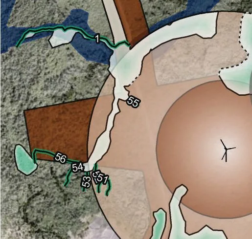
For the Burchill Wind Farm in Saint John, developed by Natural Forces with Saint John Energy, our team’s work covered a 1,658 hectare site for 10 turbines totalling roughly 42 to 45 MW. Alongside watercourse and wetland delineation and a permitting roadmap, we drilled boreholes and dug test pits across the site to characterize the fractured igneous and volcanic bedrock. Turbine foundations and access roads are only as good as the rock and soil they sit on, and knowing where the bedrock was sound, where it was broken and where overburden was deep let the designers plan foundations and roads before the first load of gravel moved.
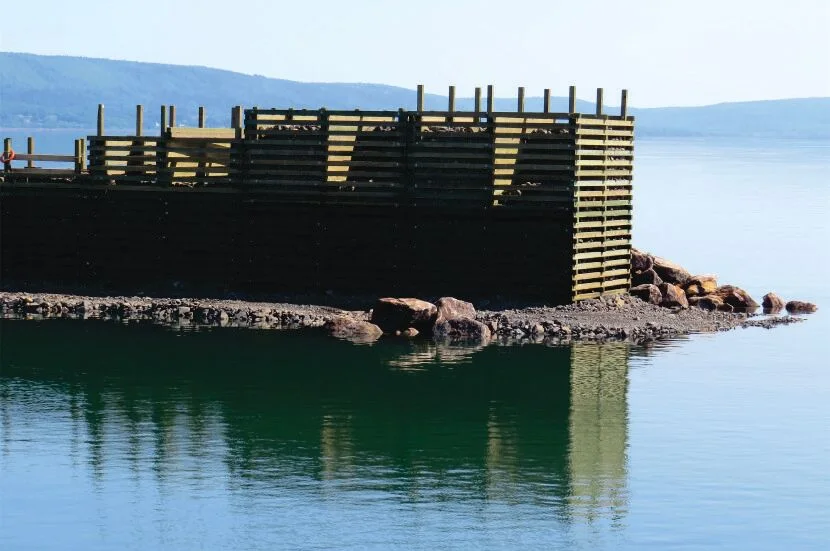
At Digby Harbour in Nova Scotia, poor soils beneath a planned 300 metre breakwater forced a redesign. Understanding the subsurface led to a combined armour stone and timber crib with ballast solution that the ground could actually support, rather than a conventional section that would have settled or failed. That is the investigation doing its job: changing the design before construction, not after.
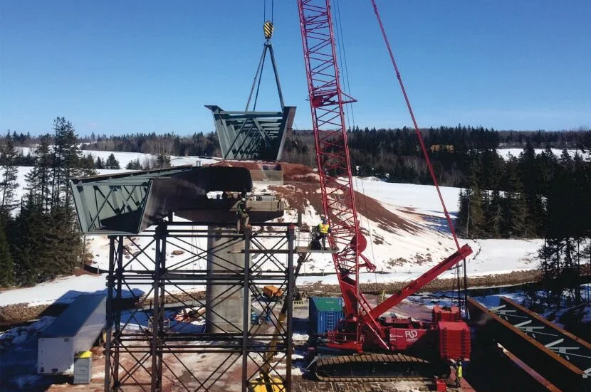
And on the Clyde River Bridge crane pads in PEI, the subsurface information was the basis for designing pads capable of supporting a Manitowoc 440 ton crawler crane for a $58 million, 140 metre bridge. Temporary works, permanent consequences.
Our geotechnical and survey group has done this work across Atlantic Canada since 1989, and the lesson has not changed: the ground does not care what the drawings assume.
The bottom line
A geotechnical investigation is not a hoop. It is the one study that tells your whole team what the site is made of and what it will do under load. Scope it to the project, do it early, and treat the report as a design input rather than a permit attachment. The sites that cause expensive surprises are almost never the ones that were properly investigated.
Key takeaways
- The National Building Code requires a subsurface investigation, including groundwater, done by someone competent in the field and scaled to the building and site.
- A geotechnical report converts raw soil and rock data into design numbers: bearing resistance, settlement, pile recommendations, excavation slopes and dewatering needs.
- Atlantic Canadian sites routinely mix shallow bedrock, glacial till, marine clay and fill within one property, so one borehole rarely tells the story.
- Skipping or under-scoping an investigation shifts the cost to construction, where unexpected rock, soft clay or water becomes a change order instead of a line item.
- Scope the investigation to the project, and book it early enough that the findings can still change the design.
Questions we get asked
How much does a geotechnical investigation cost?
It depends on how many boreholes or test pits are needed, how deep they go, whether rock coring is required, site access and the lab testing program. A small commercial building on an accessible lot is at the low end; a bridge, tall building or marine structure is much higher. Compared with the cost of a foundation redesign or a change order for unexpected rock, it is almost always a small fraction of the project budget.
How long does a geotechnical investigation take?
Fieldwork for a typical building site is often a few days once the drill rig is scheduled, followed by lab testing and reporting. Allow several weeks end to end, longer in winter, for remote or marine sites, or where rock coring and extended testing are needed. Drill rig availability in Atlantic Canada can be the biggest variable, so book early.
What is the difference between a borehole and a test pit?
A test pit is dug with an excavator, usually to a few metres, and lets the engineer see the soil profile and groundwater directly. A borehole is drilled with a rig and can go much deeper, through soft soil and into bedrock, with sampling and in-situ testing at intervals. Many investigations use both: test pits for shallow footings and utilities, boreholes for deeper foundations and rock.
Do I need a geotechnical report for a building permit in New Brunswick?
For buildings designed under Part 4 of the National Building Code (most commercial, institutional and larger residential buildings), the Code requires a subsurface investigation and the designer needs its results to size foundations. Building officials in New Brunswick, Nova Scotia and PEI commonly ask for the geotechnical report with the permit application. Confirm the specific requirement with your local building inspector.
Can I reuse a geotechnical report from a neighbouring property?
It can be useful background, but it is rarely sufficient. Conditions in Atlantic Canada can change over a few metres, from bedrock at the surface to deep clay or fill, and a report written for one structure and one footprint will not carry the engineer's responsibility for yours. Use it to help scope your own investigation, not replace it.