Short answer
In New Brunswick you need a Watercourse and Wetland Alteration (WAWA) permit for any work within 30 metres of a watercourse or wetland, including construction, land clearing, landscaping, culverts and demolition. The requirement comes from the Watercourse and Wetland Alteration Regulation (90-80) under the Clean Water Act, and applies whether or not the wetland appears on the provincial map.
Your site plan has a stream along one edge, or a low spot that holds water in spring, and the contractor wants to start clearing next month. Before anyone fires up an excavator, you need to know whether that stream or that low spot triggers a Watercourse and Wetland Alteration permit, because in New Brunswick the answer is usually yes, and the consequences of guessing wrong include stop-work orders and lost construction seasons.
Here is how the rule works, what a permit involves, and how to keep it from derailing your schedule.
What is a WAWA permit and who needs one?
The Watercourse and Wetland Alteration Regulation (90-80), made under the Clean Water Act, prohibits altering a watercourse or wetland without a permit from the Minister of Environment and Local Government. The department’s WAWA Branch administers the program and issues the permits.
The practical rule: if you plan to do work within 30 metres of a watercourse or wetland, you need a permit. The province’s own examples include construction, demolition, land clearing and landscaping. The rule reaches activities that never touch the water at all, such as grading a parking lot or clearing trees for a view.
What counts as a watercourse?
The definition is broad on purpose. A watercourse is any natural or human-made place where water collects or flows, including lakes, ponds, and channels with a rock or soil bed wider than 0.5 metres, along with their beds and banks. Water only needs to be present at some time of year. The roadside ditch that carries meltwater in April, the intermittent brook that disappears by July: both can qualify.
What counts as a wetland?
A wetland is land where water is at or near the surface, or where the soil stays saturated long enough to support water-adapted plants, soils and organisms. The province maintains a WAWA Reference Map, but the map is a starting point, not the final word. A permit is required for a wetland that meets the definition even if it is not mapped. That is why field delineation by someone who knows hydric soils and wetland vegetation is the first thing we recommend on any site with a damp corner.
Which permit type applies to my project?
| Permit type | When it applies |
|---|---|
| Standard | Medium to high environmental risk; a single alteration at one location |
| Provisional | Alterations expected to have little or no environmental impact, if specified conditions and location restrictions are met |
| Multiple | Several alterations at one site, or similar alterations at several sites, under one application |
| Certification | For applicants who hold the department’s training and certification (for example, certified installers) |
| Emergency | Situations threatening people, property, the environment or infrastructure, as determined by the department |
| Renewal or revision | Work not completed on time, or a change in scope |
Provisional permits are the quiet workhorse for small, low-risk jobs. Standard permits are where most development projects land, and where the department attaches conditions on buffers, erosion and sediment control, timing and restoration.
What do I need to apply?
Applications are submitted online. A complete application typically includes:
- Project location (a PID or coordinates helps the reviewer find it).
- A full project description.
- Fully dimensioned drawings or sketches of everything proposed within 30 metres of the watercourse or wetland.
- Photographs of the work area.
- Landowner consent if you are not the registered owner.
- Approval from the Crown Lands Branch of the Department of Natural Resources if the work is on Crown land.
- Confirmation that municipal or planning by-law approvals are in hand where the site is inside a municipality.
The provincial fee is modest (a standard permit starts at $25 and a provisional permit at $10 at the time of writing). What determines your timeline is the completeness of the drawings and the quality of the supporting work. Incomplete applications go to the back of the queue.
When can the work happen?
In-water work is typically restricted to June 1 to September 30. The window keeps machinery out of streams during fish spawning and incubation. The department can impose different windows for particular watercourses, and the window interacts with other constraints: migratory bird nesting season limits clearing in late spring and summer, and wet ground in April and November makes erosion control harder. Put all of these on one calendar before you commit to a start date.
What about wetland compensation?
Where a project will permanently fill or drain wetland, the province generally expects the loss to be avoided first, minimized second, and compensated last. Compensation usually means restoring, enhancing or creating wetland elsewhere, and the department publishes separate guidance on how it is calculated. Compensation ratios and acceptable options are set case by case, so get the department’s position in writing early rather than assuming a number. Wetland restoration is work our team has delivered, for example the Matthew’s Cove Wetland Restoration in Quispamsis, which earned an ACEC-NB Engineering Excellence award in 2018.
Where does the WAWA permit sit among other approvals?
A WAWA permit is one layer. Depending on the project, it stacks with:
- Provincial EIA registration. Affecting 2 hectares or more of wetland is a Schedule A trigger under the EIA Regulation. See does my project need an Environmental Impact Assessment in New Brunswick?
- Federal Fisheries Act. Section 35 prohibits the harmful alteration, disruption or destruction of fish habitat without authorization, and section 34.4 prohibits causing the death of fish by means other than fishing. Simple works that follow a DFO code of practice can proceed without review. Anything else goes to Fisheries and Oceans Canada as a Request for Review, and DFO decides whether an authorization is needed, sometimes with offsetting.
- Navigation. Works in navigable waters may need Transport Canada approval under the Canadian Navigable Waters Act.
- Municipal by-laws. Many municipalities have their own setbacks and development permits.
Getting these in the right order, with the right studies feeding each one, is what we mean by a permitting roadmap, and the environmental team builds one at the start of any larger project.
What this looks like in practice
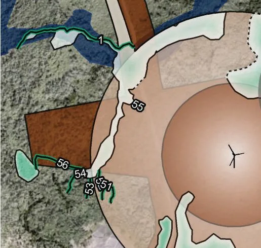
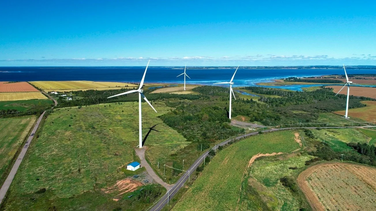
For the Burchill Wind Farm in Saint John (Natural Forces and Saint John Energy, 10 turbines, roughly 42 to 45 MW), the first environmental task on the 1,658 hectare site was watercourse and wetland delineation across the whole property, so that turbine pads, access roads and collector lines could be routed to stay clear of the 30 metre zone wherever possible. That delineation fed a permitting roadmap covering every provincial and federal approval, and it gave the geotechnical team a map of where to put boreholes and test pits on the fractured igneous and volcanic bedrock. Read the case study: Burchill Wind Farm.
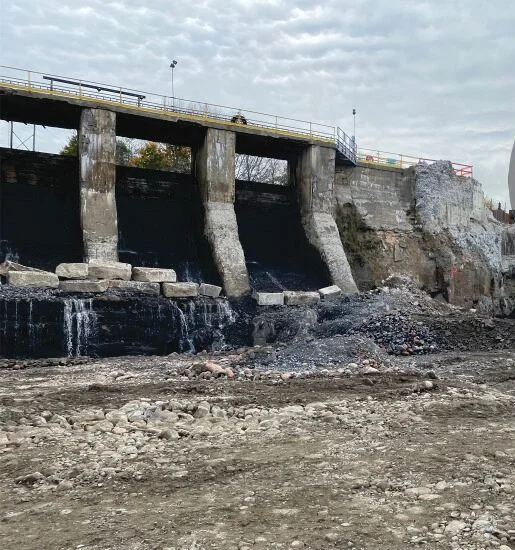
Sometimes the water is the project. At the Milltown Dam on the St. Croix River at Salmon Falls, St. Stephen, an 1881-era 3 MW dam was removed between 2023 and 2024 for Pennecon, under contract from NB Power. Our survey team supported the work with bathymetric surveys, cofferdam surveys, fish passage surveys, as-built surveys and volume surveys. On a dam removal in a river shared with Maine, the survey record is what demonstrates the work matched the permitted design. Read the case study: Milltown Dam Removal.
A checklist before you clear anything
- Have you walked the site in spring, when intermittent watercourses and wetlands show themselves?
- Has a qualified person delineated wetland boundaries in the field, not just from the reference map?
- Is every proposed activity, including clearing and grading, drawn relative to the 30 metre line?
- Does the schedule respect the in-water work window and bird nesting season?
- Have you checked whether the Fisheries Act, the EIA Regulation or a municipal setback also applies?
- Do you have landowner consent, Crown land approval and municipal approvals documented?
The bottom line
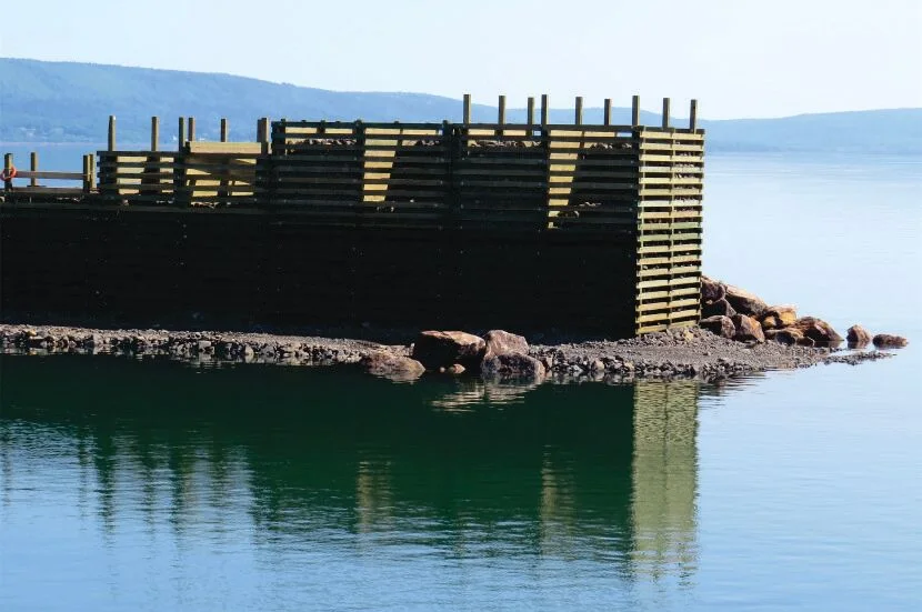
The 30 metre rule is simple to state and easy to underestimate. Treat every stream, ditch and damp hollow as regulated until a delineation says otherwise, apply early enough to catch the summer work window, and line up the WAWA permit with the EIA and Fisheries Act questions in one plan. If you are also building on the shoreline, our guide to designing wharves, slips and breakwaters for the Bay of Fundy picks up where this one leaves off.
Key takeaways
- The 30 metre rule is measured from the bank of a watercourse or the edge of a wetland, and it covers land clearing and landscaping, not just in-water work.
- A wetland does not have to be on the provincial WAWA Reference Map to be regulated; if it meets the definition, it counts.
- In-water work is typically restricted to June 1 to September 30, so a late application can cost you a whole construction season.
- Standard permits currently carry a modest fee; the real cost is the delineation, design and timing, not the permit itself.
- Larger wetland impacts can also trigger EIA registration (2 hectares or more) and a federal Fisheries Act review, so map all three early.
Questions we get asked
How close to a stream can I build in New Brunswick without a permit?
Any alteration within 30 metres of a watercourse or wetland requires a WAWA permit, so for practical purposes a building, driveway, cleared area or septic field closer than 30 metres needs one. The permit may be granted with conditions such as retaining a vegetated buffer, but you cannot skip the application.
What counts as a watercourse under the WAWA Regulation?
The province defines a watercourse broadly: any natural or constructed place where water collects or flows, including lakes, ponds and channels with a rock or soil bed wider than half a metre, together with their beds and banks. Water only needs to be present part of the year, so an intermittent stream that is dry in August is still a watercourse.
How much does a WAWA permit cost?
The provincial fee is small: at the time of writing, a standard permit starts at $25 for a single alteration, with a capped per-alteration fee for multiple alterations, and a provisional permit starts at $10. The meaningful costs are the supporting work: wetland delineation, drawings, erosion and sediment control plans and any wetland compensation required.
When can I do in-stream work in New Brunswick?
In-water work is typically limited to June 1 to September 30 to protect fish during spawning and incubation. The department can set different windows in the permit conditions for specific watercourses or species, so confirm the dates on your permit rather than assuming.
Do I also need federal approval under the Fisheries Act?
Possibly. The Fisheries Act prohibits the harmful alteration, disruption or destruction of fish habitat and the death of fish by means other than fishing. If your work cannot follow a DFO code of practice, you submit a Request for Review to Fisheries and Oceans Canada, which decides whether an authorization is required. A WAWA permit does not substitute for that review.