Short answer
Designing a wharf, slip or breakwater on the Bay of Fundy means designing for a tidal range of roughly 8 metres at Saint John and up to about 16 metres in the upper bay, strong tidal currents, sea ice and often weak seabed soils. Structures must work fully submerged and fully exposed twice a day, resist corrosion and ice loads across the whole tidal zone, and be founded on soils confirmed by investigation. Construction is planned around tide windows and permits under the Fisheries Act, Canadian Navigable Waters Act and provincial rules.
If you own, operate or are planning a wharf, slip, pier or breakwater anywhere on the Bay of Fundy, you are dealing with a body of water that drains and refills on a scale most marine engineers never see. Twice a day, the structure you are responsible for goes from standing in the sea to standing on the mud. Designing for that is a discipline of its own.
How big are Fundy tides, really?
The Bay of Fundy’s tidal range is the largest in the world. At Saint John harbour, the range is about 8 metres, and it grows as the bay narrows toward the Minas Basin, where it reaches roughly 16 metres. Something on the order of 100 billion tonnes of water move in and out on every tide.
For a designer, the number that matters is not the tide itself but what it does to a structure:
- The “waterline” is a zone, not a line. A wharf at Saint John has about 8 vertical metres of structure that is alternately submerged and exposed. In the upper bay, that zone is the height of a five-storey building.
- Currents are strong. Moving that much water through a narrowing bay produces tidal currents that load structures, scour the seabed around piles and make underwater work hazardous and brief.
- Ice. Winter brings floating ice and ice that forms on structures and lifts with the tide, pulling on piles and fenders.
- Vessels sit on the bottom. At many Fundy harbours, boats dry out at low water. Slips and berths have to be designed for grounded vessels, not just floating ones.
What does the tidal zone do to a structure?
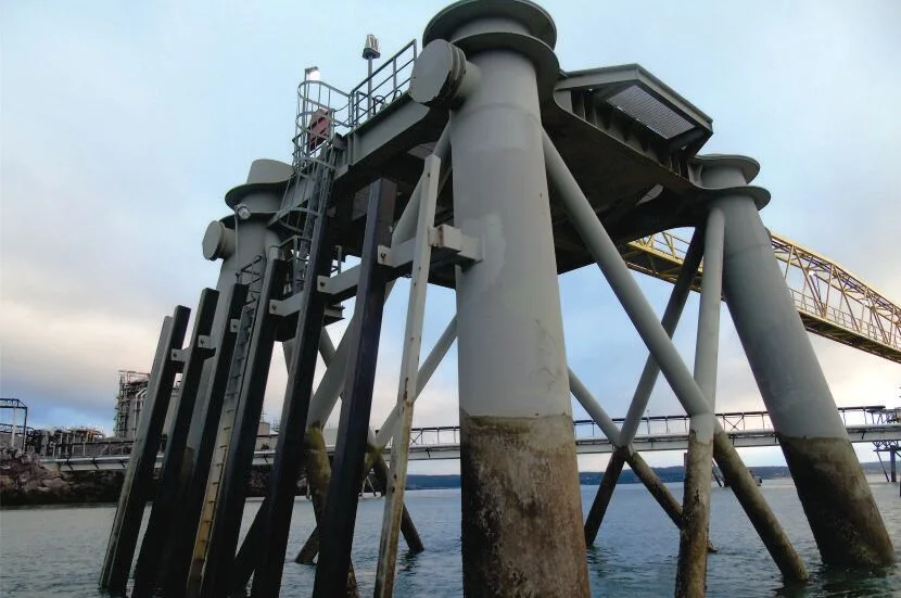
The band between low and high water is where marine structures age fastest. Steel corrodes most aggressively in the splash and tidal zones, where it is wet, oxygenated and salted repeatedly. Concrete sees chlorides and freeze-thaw cycles at the same time. Timber faces marine borers below water and weathering above it. Fasteners, bracing and connections live in all of these conditions at once.
This is why durability drives Fundy design more than strength. Thicker steel sections or protective coatings in the tidal zone, concrete mixes and cover detailed for chlorides and frost, cathodic protection where appropriate, and, above all, access for inspection and repair. A structure that cannot be inspected will be replaced sooner than one that can.
What questions does the design need to answer?
| Design question | What it depends on |
|---|---|
| What type of structure? | Seabed soils, exposure, vessel size, budget, and whether vessels will dry out |
| How deep must foundations go? | Bearing and scour conditions from a geotechnical investigation, and how currents move the bottom |
| What loads govern? | Berthing and mooring forces, wave action, ice, live loads on deck, and the hydrostatic effects of a tide that drops 8 metres behind a bulkhead |
| How will it be built? | Tide windows, barge access, low-water working from land, and the season |
| How will it be maintained? | Inspection cycle, access at low water, and replaceable components in the tidal zone |
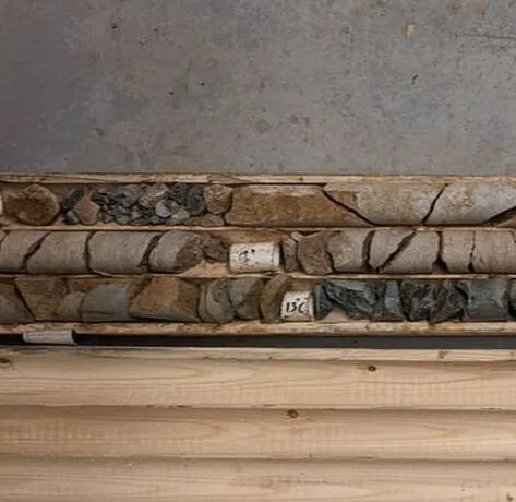
The first row is the one owners underestimate. The seabed decides. A breakwater or wharf on bedrock can be a simple, heavy section. The same structure on soft marine clay or loose fill needs a different concept entirely, and only a proper geotechnical investigation with marine boreholes will tell you which site you have.
How do you build around the tide?
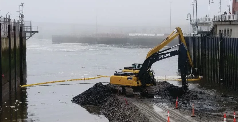
The tide that complicates design can simplify construction. Where the bottom is exposed at low water, work that would otherwise need barges and divers can be done from land during the low-tide window. The planning rules:
- Build the tide table into the schedule. Each day has two windows; their length and timing shift across the month. Spring tides give the longest exposure.
- Plan access. A temporary road or working platform across the intertidal zone, designed to be removed and with erosion and sediment controls in place.
- Sequence the work. Pile driving, cribwork, dredging and placing stone are all easier when the crew can see what they are doing.
- Protect the environment. Intertidal zones are fish habitat. Timing windows for fish, turbidity controls and containment of any contaminated sediment are part of the method, not an afterthought.
- Survey continuously. Bathymetric and as-built surveys before, during and after confirm quantities and that what was built matches what was designed.
What approvals apply to marine work?
Marine structures in Atlantic Canada sit under overlapping jurisdictions. In broad terms:
- Fisheries Act. Work in fish habitat is reviewed by Fisheries and Oceans Canada. Projects that could cause harmful alteration, disruption or destruction of habitat may need an authorization and an offsetting plan.
- Canadian Navigable Waters Act. Works in, on, over or under navigable water are submitted to Transport Canada. On scheduled waters, which include the busiest waterways near ports, a work that may interfere with navigation needs an approval. Elsewhere, the process depends on whether the work may interfere and often involves a public notice.
- Provincial permits. In New Brunswick, work within 30 metres of a watercourse or wetland, which includes coastal waters, needs a Watercourse and Wetland Alteration permit. Our guide to WAWA permits covers the details. Larger projects may require EIA registration. Nova Scotia and PEI have parallel approvals.
- Port and harbour authorities. Many wharves sit on federal or municipal harbour lands with their own lease and approval conditions.
Running these in parallel, with one team doing the environmental surveys, the engineering and the submissions, keeps the permits from becoming the critical path.
What this looks like in practice
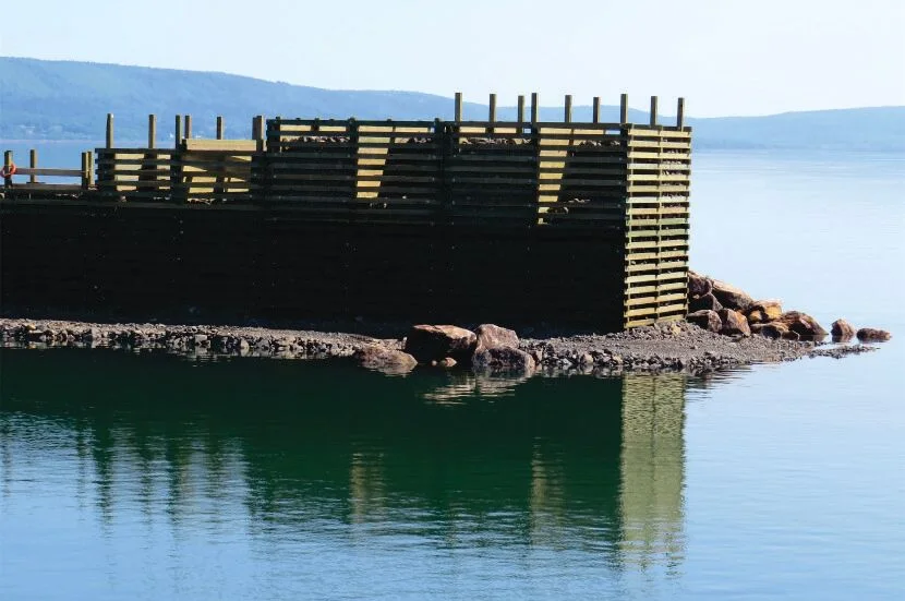
At Digby Harbour in Nova Scotia, the Digby Harbour Port Association needed a 300 metre breakwater, and the original concept did not suit the poor soils found beneath the site. Between 2008 and 2013, our team redesigned the structure as a combination of armour stone and timber crib with ballast, a solution that spreads load and tolerates the seabed conditions rather than fighting them. It is a good example of the seabed, not the water, dictating the structure.
At Market Slip in uptown Saint John, we helped the City remove roughly 3,000 cubic metres of sediment in 2019 and 2020 without a dredge barge. The method used the tide: a temporary road built into the slip let land-based equipment work at low water each day. Because the sediment carried low-level contamination, it was placed in a lined disposal cell rather than dumped. The Fundy tide was the construction method.
And at Canaport LNG’s multi-purpose pier at Mispec Point, our team carried out the five-yearly structural survey over the winter of 2014 and 2015, above and under water, with divers working in strong tidal currents. The pier receives Q-Max LNG carriers, the largest in service, and a documented condition assessment on a regular cycle is how an owner keeps a structure like that safe and insurable.
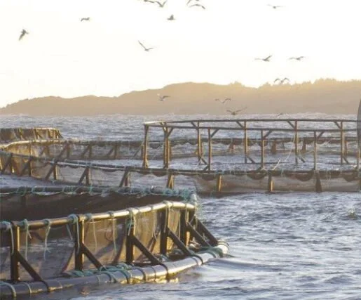
Our geotechnical and survey group has also inspected more than 300 H-piles at Long Wharf in Saint John, designed a sheet-pile community wharf at Renforth, and provided permitting for Irving’s monobuoy and anchor chain replacement. For aquaculture clients, the same tidal forces shape mooring and site selection work.
The bottom line
Fundy tides turn a waterline into a zone, make durability the governing design issue, and reward builders who plan around low water instead of fighting it. The seabed decides the structure type, the tidal zone decides the materials, and the permits decide the schedule. Get all three on the table early, with people who have worked in this bay before.
Key takeaways
- Fundy tides reach about 8 metres at Saint John and roughly 16 metres in the upper bay, so the design 'waterline' is a zone several storeys tall.
- Twice-daily wetting and drying, ice and strong currents attack the tidal zone hardest, so durability and inspection access drive material choices.
- Seabed soils decide the structure type more often than the water does; a breakwater on soft ground needs a different section than one on rock.
- Low tide is a construction asset: with planning, work that would need barges elsewhere can be done from a temporary road at low water.
- Marine works need federal and provincial approvals (Fisheries Act, Canadian Navigable Waters Act, and in NB a WAWA permit), so start the permitting early.
Questions we get asked
How high are the tides in the Bay of Fundy?
The Bay of Fundy has the highest tidal range in the world. The range is about 8 metres at Saint John harbour and increases toward the head of the bay, reaching roughly 16 metres in the upper bay around the Minas Basin. About 100 billion tonnes of water move in and out of the bay on each tide.
What permits are needed to build a wharf or breakwater in New Brunswick?
Typically a Fisheries Act review (and possibly an authorization) from Fisheries and Oceans Canada for work in fish habitat, a submission under the Canadian Navigable Waters Act to Transport Canada for a work in navigable water, and a provincial Watercourse and Wetland Alteration (WAWA) permit from New Brunswick's environment department. Larger projects may also trigger an Environmental Impact Assessment registration. Nova Scotia and PEI have their own provincial approvals.
How often should a wharf or pier be inspected?
Owners of commercial piers often adopt a regular cycle, such as every five years, with above-water and underwater (diver) inspection of piles, cross-bracing, fenders and decking. Structures in the Fundy tidal zone deteriorate faster than those in calmer water, so a periodic engineered inspection with a written condition report is good practice and often an insurance or regulatory expectation.
What is the best material for a wharf in salt water with ice?
There is no single best answer. Steel piles and sheet piles are strong and fast to install but need corrosion protection and extra thickness in the splash zone. Timber cribs filled with rock are a traditional Atlantic Canadian solution that handles poor soils and ice well. Concrete is durable if detailed for freeze-thaw and chlorides. The choice depends on soil conditions, exposure, vessel loads, budget and how the structure will be maintained.
Can dredging be done without a barge in the Bay of Fundy?
Sometimes, yes. Where the tidal range exposes the seabed at low water, a temporary access road can let land-based equipment excavate and haul material during the low tide window each day. It requires careful scheduling, environmental controls and a plan for where dredged material goes, especially if it carries low-level contamination.